![['the civilized explorer'.]](../src/civex.gif)
We drove to the base of Mont Pele and climbed to the top during our visit to Martinique in 1999. This Web page has photographs and commentary about our hike. We describe the difficulties in more detail on Climbing Mont Pelée.
Copyright information and how to get permission to use the images is here. We have photos-only pages at our Travel page.
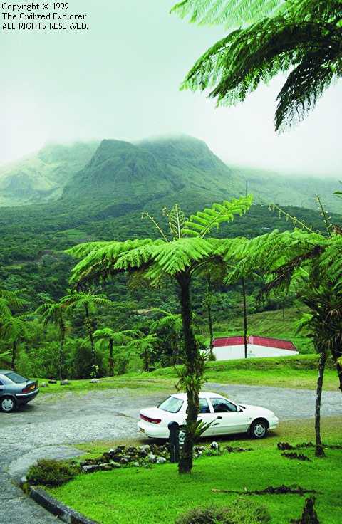 We took this photo on way to the restaurant where we had lunch.
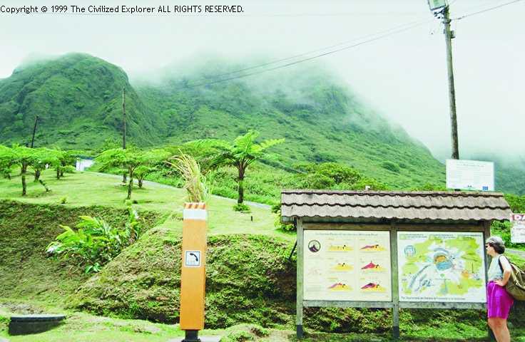 The beginning of the trail.
The snack bar is behind and the volcano in front of the camera, and this
hiker is looking at the map of the caldera, with the camera facing toward the
Caribbean on the west of Mont Pele. The elevation here is 822 meters.
On the left of the board are diagrams showing how the walls of the caldera
were blown away and collapsed in the 1902 eruption and the lava flow. Further
to the left is a telephone for emergency help.
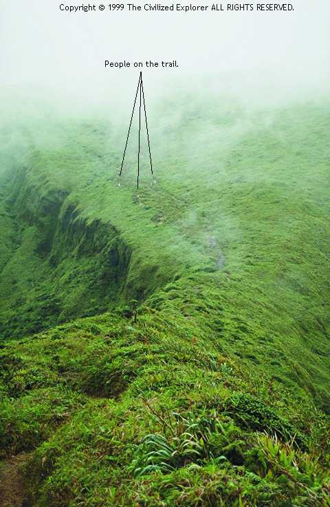
"Looking up the volcano"
Facing the Caribbean still, we thought we were seeing the top of the volcano in
this view. In the photographs, scale is impossible to judge because of the
uniform vegetation on the sides of the volcano. The people in this photograph
were clearly recognizable as people at the time. We thought we had a fairly
reasonable climb to the top, and we would look down into the caldera. Ha!
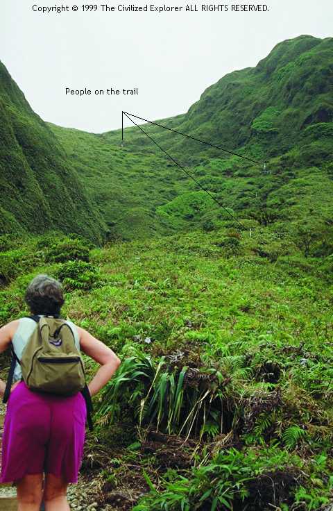
"Looking toward the saddle"
We got to the top, and the climb turned really steep, and we thought
we would have a tough climb to the point where this photo was taken and we
would look down into the caldera. Ha! This was the view, instead -- another
long hike, but more nearly level. If you look at the previous picture, you
will notice the hump on the right; this photo is taken from that hump looking
toward the Caribbean. You are looking down from the hump to a saddle; you
cannot see the steep climb past those people on the trail. The people are
spread out trying to avoid walking in mud puddles, and one of the people fell
just after we took this picture.
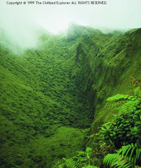
"Looking into the caldera"
Finally! We reached the top and could look down into the
caldera. This was tricky. The lush grasses and low brush grew so densely that
we could not see the ground. The caldera walls are extremely steep,
and stepping to the edge was as likely to put your feet on a bush on the
inside of the caldera as it was to put your foot on the ground on the safe
side. Slipping there was a life- threatening proposition. We chose to lie on
the ground on the outer wall and look over, keeping our weight (hopefully) on
the safer side. You can see from the photo that it was taken over the edge,
but you cannot get the scale -- the caldera is very deep, a depth
which you cannot really appreciate from this picture. Just after taking this
picture, the clouds came in even thicker, completely obscuring the view into
the caldera (and outside of it, too).
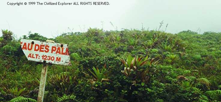 "Plateau des Palmes"
Plateau des Palmes is where the clouds started coming in.
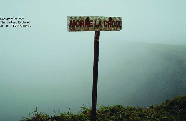 "Morne la Croix"
Morne la Croix, at 1242 meters, was where we decided to turn back. The clouds made it
impossible to see more than a hundred meters, the wind was damp and cold, and
the trail was a series of mud puddles, alternating with mud.
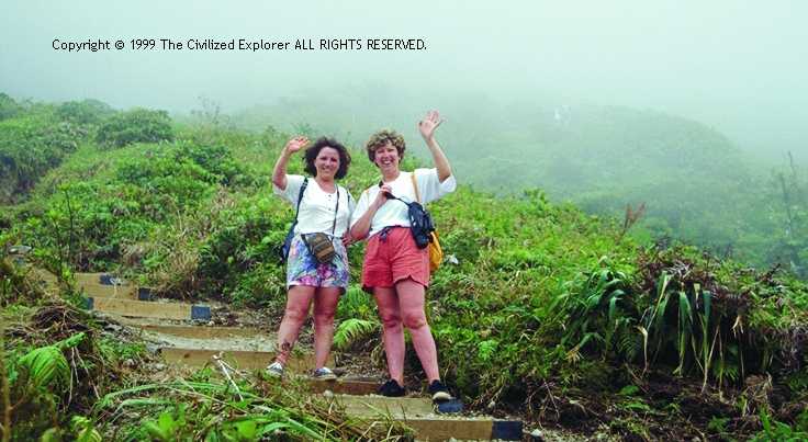 "Two hikers coming back"
On our way back down, we slippped, slid, and fell (see
Climbing Mt. Pelé for the details), and we
heard these women ahead of us in the fog, slipping and sliding their way down,
too. We reached the lower regions of the volcano where it was safe to pass
them, and we took their picture. It was here that a man approached us. He
had left his new bride at the snack shop and wanted to know how long the
climb was and how hard. The four of us told him, he gave it careful thought
for two seconds, and went back to his wife.
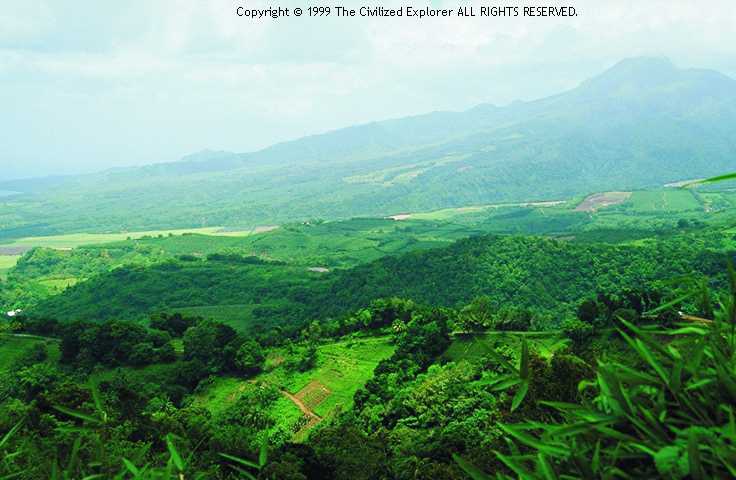 "Verdant fields." Pele is that bump on the right. The view is spectacular, and we wish
you could have seen it with us.
"Verdant fields." Pele is that bump on the right. The view is spectacular, and we wish
you could have seen it with us.
At the foot of Mont Pele, the lava and ash have left a verdant and fertile
field which the farmers put to good use.
See our Table of Contents for links to other photo pages.
All photographs are Copyright The Civilized Explorer. ALL RIGHTS RESERVED. You may not make copies of these photographs for public use without prior permission. See our copyright page for further information, including how to get permission.
Copyright © 1999, The Civilized Explorer. ALL RIGHTS RESERVED.